Distance: 3 miles
Time: Allow 1 - 1.5 hours
A Medium walk, reasonable for fit walkers. Mostly level on surfaced paths / roads but with some uphill sections through woods across fields. Some stiles. Good views across farmland near Ecclesfield. Boots or stout shoes are advisable.
Map: Ordnance Survey Explorer 278 Sheffield and Barnsley.
Start: Jumaira Spice Restaurant, junction of Church Street and Ecclesfield Common.
Public Transport: For information on public transport ring the South Yorkshire Traveline on 01709 515151 or visit www.travelsouthyorkshire.com.
Car Parking: Avoid parking on the common. There is a small car park in Ecclesfield park opposite Morrisons.
Public Toilets: None on route.
Refreshments: None on route
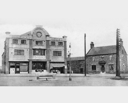
The building which is now the Jumaira Spice restaurant was previously the Arundel Inn. It was named after the duke of Norfolk who also had the title of the Earl of Arundel. From 1920 until it was demolished in 1959 the Cinema House also stood on this corner. The cinema was renamed the Essoldo in 1950.
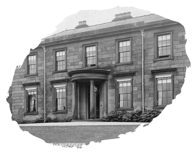
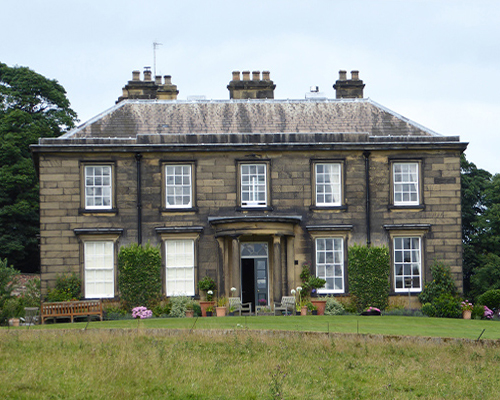
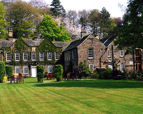
The present hall was built by William Smith in 1824, demolishing an earlier c14th hall on the same site. Barnes Hall was the home of the Smith family until the 1950s. The former physical education teacher training college at Wentworth Woodhouse was named after one of the last inhabitants of the Hall, Lady Mabel, who lived here from the time of her marriage until her death in 1951.
Another folley on the Wentworth Woodhouse estate, this triangular tower with a round structure on top is visible in the far distance beyond Keppel’s Column. It was built for the First Marquis of Rockingham in honour of George II following the quelling of the Jacobite Rebellion in 1745. It is occasionally open to the public.
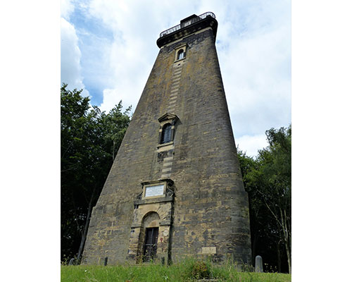
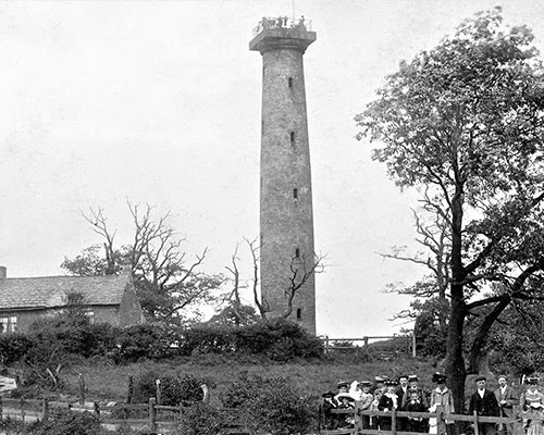
The slender column you can see on the horizon from the footpath leading in front of Barnes Hall to the top of Elliott Lans is Keppel’s Column. It was built in 1776 by Lord Rockingham of Wentworth Woodhouse to commemorate the acquittal of his friend Admiral Keppel on a charge of cowardice. At one time it was possible to ascend the staircase inside the column to view the surrounding countryside, but the column is now closed to the public.
It has been suggested that the stone could be the base of a cross and may be connected with Ecclesfield Church and Priory, which are known to have been in the possession of St Wandrille’s Abbey in Normandy by 1142.

Records show a house called Launderhouse occupied the site of the present Whitley Hall as early as 1406 but the oldest surviving part of the present building dates from 1584. From the early c17th to the late c18th the Hall was the home of the Shirecliffe family, until it was sold and became a boy’s boarding school for some 80 years. Whitley Hall became a hotel and restaurant in the late 1970s. For more information see J. & M. Jones (2002) Whitley Hall - an illustrated history

Copyright 2021 Ecclesfield Parish Council | Website by Aubern Creative